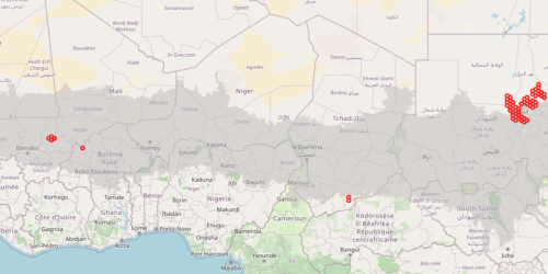
17- Identification of area of interest for pivot irrigation systems (AOIp)
Map illustrating the hexagonal cells that define the Area of Interest (AOI) for pivot irrigation systems (AOIp) in the Sahel region. Each hexagon represents a zone identified through satellite imagery as hosting circular irrigated fields, such as those driven by central pivot systems.