In this section we present some historical maps preserved at the Geography Library and the Museum of Geography of the University of Padua, the first museum of its kind in Italy dedicated to Geography. Its patrimony has recently been considerably enriched thanks to the generous donation of Armando Morbiato, thus establishing the Morbiato Collection.
The historical maps were selected and analysed by Chiara Gallanti, curator of the Museum, and by Chiara Forner and Marco Napolitano, history students. They are also responsible for the map records. For any reference or quotation, please attribute the authorship to Chiara Gallanti, Chiara Forner and Marco Napolitano.
All images are licensed under a Creative Commons CC-BY-NC-SA 4.0 License.
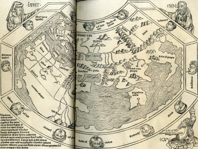
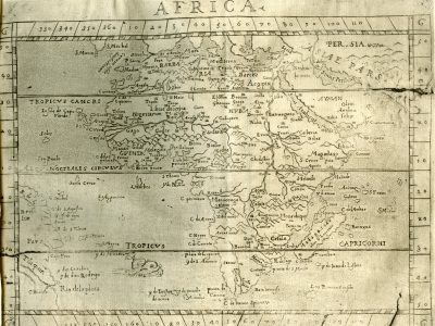
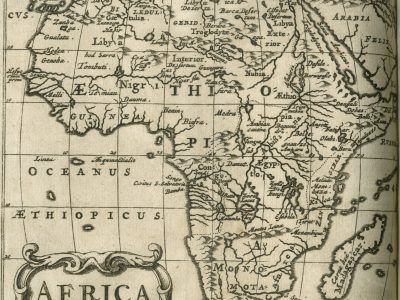
Affricae tabula nova
Sebastian Münster, Cosmographey, das ist Beschreibung aller Länder, Herrschaften und fürnemesten Stetten des gantzen Erdbodens, 1588 (1614)
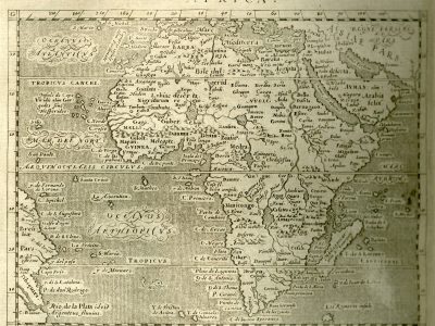
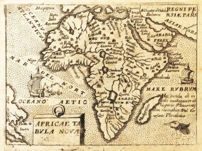
Africa
Giovanni Antonio Magini, Geografia cioè Descrittione universale della Terra., 1596 (1612)
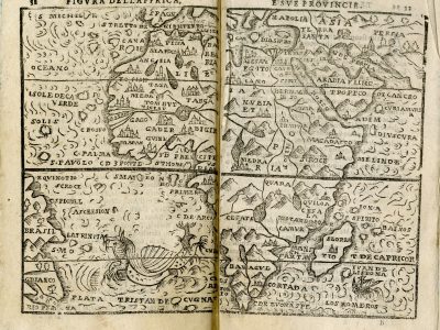
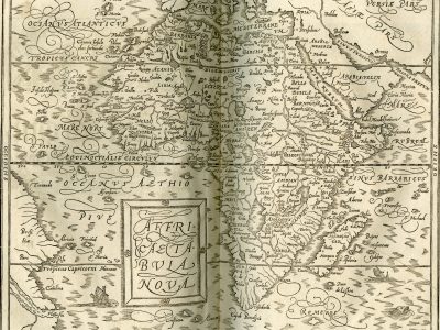
Figura dell’Affrica e sue provincie
Giuseppe Rosaccio, Teatro del cielo e della terra, 1598
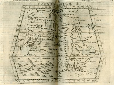
TABVLA AFRICÆ IIII
Giuseppe Rosaccio, Geografia di Claudio Tolomeo alessandrino, tradotta di greco nell’idioma volgare italiano da Girolamo Ruscelli, et hora nuouamente ampliata da Gioseffo Rosaccio, 1599
Africa
Philipp Clüver, Introductionis in universam geographiam tam veterem, quam novam libri sex, 1624 (1661)
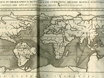
Tabula geographico-hydrographica
Athanasius Kircher, De onderaardse Wereld (Mundus Subterraneus), 1665 (1682)
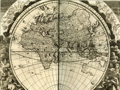
Facies altera hemispherii terrestris
Johann Zahn, Specula Physico-Mathematico-Historica, 1696
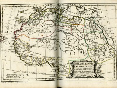
Barbarie, Egypte, Nigritie, Guinee, Nubie, Abissinie
Gilles Robert & Didier Robert de Vaugondy, Nouvel atlas portatif, 1757 (1762)
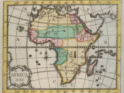
Africa XXI
Christiaan Andreas Sepp, Nuovo atlante portatile, 1758 (1777; 1785)
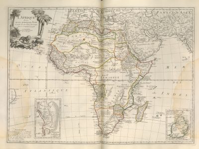
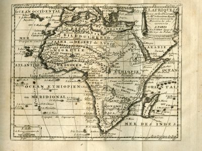
L’Afrique divisée en ses principaux Etats
Francesco Santini, Atlas universel dressé sur les meilleures cartes modernes, 1776
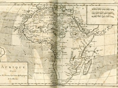
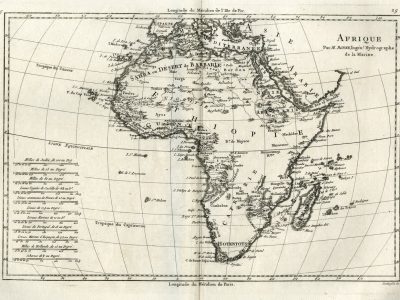
Afrique dressée par M. Bonne
Guillaume Thomas François Raynal, Atlas de toutes les Parties Connues du Globe Terrestre dressé pour l’histoire philosophique et politique des établissements et du commerce des européens dans les deux Indes, 1780
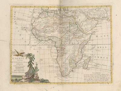
L’Africa divisa ne’ suoi principali Stati, di nuova projezione
Antonio Zatta, Atlante novissimo, illustrato ed accresciuto sulle osservazioni e scoperte fatte di più celebri e più recenti geografi, 1778-1785
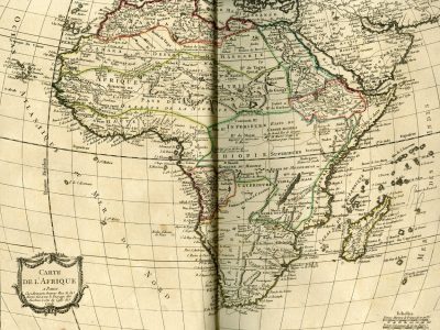
Carte de l’Afrique
Louis-Charles Desnos, Atlas élémentaire de la géographie contenant les quatres parties du monde, 1784
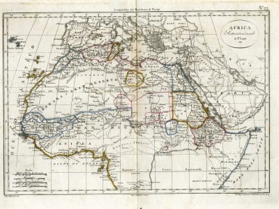
Africa settentrionale
Luigi Maria Galanti, Atlante Universale e Portatile di Geografia Antica e Moderna, 1817
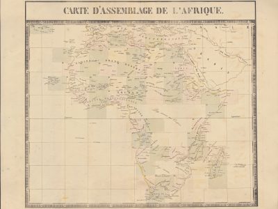
Carte d’assemblage de l’Afrique
Philippe Vandermaelen, Atlas Universel de Géographie Physique, Politique, Statistique et Minéralogique, 1827
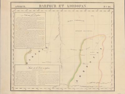
Darfour et Kordofa
Philippe Vandermaelen, Atlas Universel de Géographie Physique, Politique, Statistique et Minéralogique, 1827
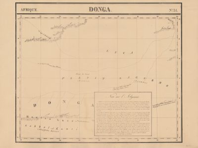
Donga
Philippe Vandermaelen, Atlas Universel de Géographie Physique, Politique, Statistique et Minéralogique, 1827
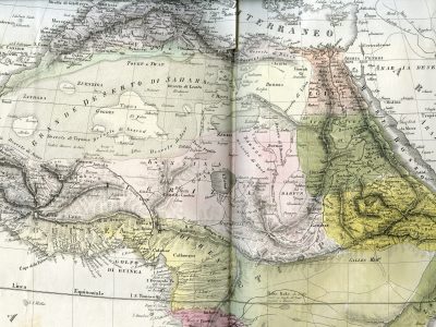
L’Africa divisa nelle sue principali regioni
Francesco Costantino Marmocchi, Atlante di geografia universale, 1838
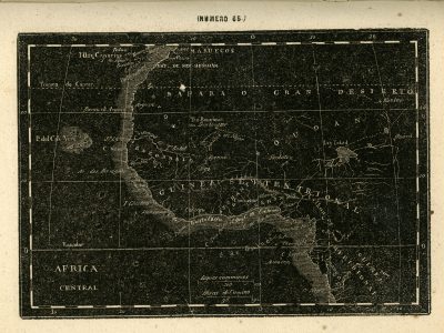
Africa central
Ángel Fernández de los Ríos, Atlas geográfico de la tierra, 1849