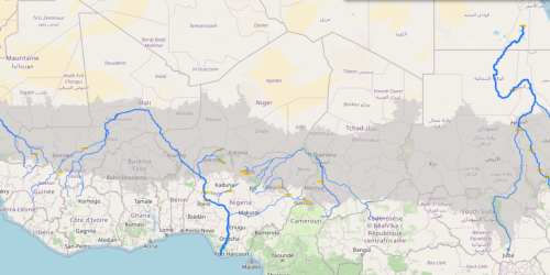
15- Main dams and river flow
The map provides insights into how the flow of watercourses evolves as they receive additional water input from tributaries along their course. At each junction of a tributary to one of the major rivers, and taking into account roughly the size of the contribution, the blue line outlines the river’s flow becomes proportionally thicker. The map indicates major dams that regulate and manage the flow.