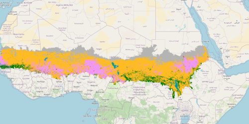
7- Land cover map of the Sahel
Land cover/use classes have been simplified into six main categories: (1) shrubs and herbaceous vegetation, (2) cultivated and managed vegetation, (3) forest, (4) urban/built-up areas, (5) herbaceous wetlands, and (6) bare or sparsely vegetated areas (including mosses and lichens). The classification is based on Copernicus Global Land Cover (GLC) data, harmonized to ensure consistency in the spatial analysis of land degradation indicators.