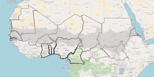
5- Sahel’s political, weighted borders
To assess the borders, we used two spatial distinctions: distance from the capital and proximity to two particularly exposed tripoints. We also identified four parameters to assign different weights to the borders of different countries. This made it possible to construct a representation that visually renders the complex situation of state borders in the Sahel, highlighting where they appear weakest or even irrelevant and where, on the contrary, they are most consolidated.