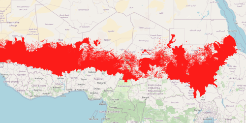
9- Spatial distribution of the indicators considered for the calculation of the Convergence of Evidence
Map of the individual indicators used for calculating the Convergence of Evidence (CoE). Each map represents an environmental or human-induced stress factor relevant to assessing land degradation in the Sahel region. The nine selected indicators are: population density, population change, drought risk, soil erosion (RUSLE), built-up areas, water stress, groundwater table decline, tree cover loss, and land productivity dynamics. The data come from global sources such as Copernicus, the World Resources Institute (WRI), the Global Human Settlement Layer (GHSL), and the Joint Research Centre (JRC). The spatial analysis of these indicators allows the identification of areas where multiple pressures converge, indicating a high risk of degradation.