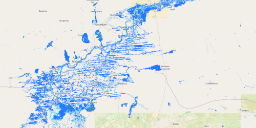
12- The hydrological Sahel— core area of the Inner Niger Delta (Mali).
The map shows the distinction between the hydrological core (light blue), i.e., areas flooded even during the driest years, the areas flooded only during the wettest biennium (dark blue), and the permanent waters (dark green). This classification highlights the Inner Niger Delta as a key water resilience area under variable climatic conditions.