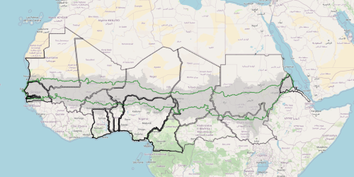
6- A first cartographic synthesis: Pluviometric and political Sahel
The map collects and intersects two different Sahels, highlighting both the mobility of the area in space and the existence of a Sahelian core and emphasising the changes in value of the state borders, depending on the political–economic evolution of the different countries.